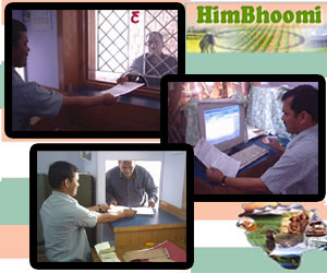
 Initiated at the time of Mughal emperor Akbar, land records were maintained for the collection of the revenue. The system continued at the time of British rule for the same purpose. Now the state comprises 12 districts having 110 tehsils in a total area of around 55,673 sq kms. Under Section 31 – 37 of Himachal Pradesh Land Revenue Act, land records of all settlements must be made with continuous updation. There are various documents involved in land records including Shajra Nasb (Pedigree Table), Jamabandi and associated statements (Records of Rights), Intkal (Mutation Register), Khasra Girdawari (Harvest Inspection) Register, Khatoni (Field Map) and Village, Tehsil & District Note Book (Lal Kitab). However the manual system has multiple problems that made the whole method ineffective in making policy decisions for planning. Most of the time data is not updated and extracting the actual details becomes burdensome for the revenue department.When the manual maintenance of land records seemed inadequate, the Government of Himachal Pradesh pulled up the socks to digitize the land records. A big relief to the citizens of Himachal Pradesh state as land records are now just a click away. The automated process has made acquiring land records effortless. The computerization of records will facilitate easy maintenance of records and grease legal changes like transfer of ownership, partition, land acquisition, lease etc. Using the mechanized process, the documents will accurately reveal recording details such as collection of land revenue, cropping pattern etc and make the records tamper proof.HimBhoomi: The joint effort of Revenue Department and NIC resulted into software that digitizes the land records. The technology standardizes the documents and can be executed easily by a Patwari. Apart from all technical details, computerized land records have many advantages over the manual ones. There are multiple modules that carryout different process including Gram Nideshika that aids in entering details of the location, Master Entry Module that allows entering Shajra Nasb, Jamabandi etc, HimBhoomi-LaPort Module that ports the data from district to tehsil, HimBhoomi-Mutation Module that helps entering mutation details and HimBhoomi-ROR (Nakal) Distribution Module that provides instant ROR printouts.How to get land records:
- The owner who needs a copy of Records-Of-Rights should visit the Tehsil centre. There you have to fill up “CD2-Application Form” and affix the stamps towards copy fee.
- You have to write Khewat/ khatoni/ Khasra number against which copy is required. You can make a choice of taking copy of RoR for complete Khewat / Complete khatoni(s) / single Khasra.
- After filing the form completely, hand it to the operator at the counter.
- The clerk will go through your application and enter the details like Khewat/ khatoni/ Khasra number in the HimBhoomi software to extract the land record. Once the information is proved correct, nakal can be printed out instantly.
- Before taking the copy of ROR, you have to pay the required service charge to the clerk. The total process will take less than 15 minutes.
Improvements in Future: Government is planning to encrypt the data and introduce bar codes in the nakal. Linking with GIS system and making available the mutation copies are also few of the improvements to come up in HimBhoomi.Land records are now accessible online for all the tehsils of 12 districts which include Shimla, Kullu, Bilaspur, Hamirpur, Chamba, Kangra, Solan, Kinnaur, Lahaul-Spiti, Una, Mandi and Sirmaur.For more details, visit: http://himachal.nic.in/himbhoomi/main.htm Check : Uttarakhand Land Record | Bhulekh – U P Land Records | Jamabandi – Haryana Land Records | Punjab Land recordsзайм на карту без отказов круглосуточновзять кредит онлайн
Wer i get sample of jamabandi on himbhoomi. i wnt do my land record registration in himachal pradesh.
You can find the computerized sample of jamabandi in the link given below http://himachal.nic.in/himbhoomi/images/OtherImages/Comp_Jamabandi.pdf