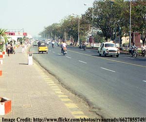
 Hyderabad: Hyderabad Metropolitan Development Authority (HMDA) is sketching the plans for the proposed Regional Ring Road (RRR). HMDA has successfully carried out the construction of the Outer Ring Road (ORR) which is now on the verge of completion. HMDA has decided to plan out the Regional Ring Road, for which it has invited proposal for preliminary feasibility report. Regional Ring Road will stretch over the 210 km of existing roads and the rest 80 km will be a new alignment.HMDA official said that the RRR will be made access-controlled depending on the development and traffic situation in the future. Once traffic on RRR increases and the surrounding regions are developed, it will be converted into partially-controlled and further into a fully-controlled stretch. The toll would be collected from the commuters traveling on the lines of Outer Ring Road.The plan of RRR is sketched keeping in mind the future developments and growth of the regions adjacent to the proposed RRR. The feasibility report of the RRR will include mapping of proposed RRR alignment, land use, water bodies, hillocks, religious structures, village settlements, forest land, bridges, broad mapping of population and major pedestrian crossing etc. The feasibility report mapping would be done by using GIS techniques and remote sensing through digital global positioning system.The proposed regional ring road will pass through regions which come in the extended areas of the HMDA which includes villages like Malkapuram, Eddumailaram, Chevella, Shabad, Shadnagar, Daudguda, Narsapur, Sangareddy, Toopran, and Ibrahimnagar etc. The development of RRR will be the vital catalyst in the growth of the Hyderabad Metropolitan Region. The development of RRR will be carried out in the same design concept like ORR.займ на карту без отказов круглосуточновзять кредит онлайн